Visualizations from Fall 2017
I wanted to have an online record from the visualization class I took in Fall 2017. Even if it’s just a blog post. I put a lot of hours into the class, after all.
One of our projects was to use Sketchup, Google Earth and Photoshop to depict a new development near Walter Payton Prep. I gave the townhomes a Dutch feel and placed them around a woonerf – giving the site the name of Walterstraat.

For the final project, we made a booklet describing a new light rail line – the “Lime Line” – along Grand Avenue through Humboldt. Coming up with the money for such a project was not an issue.
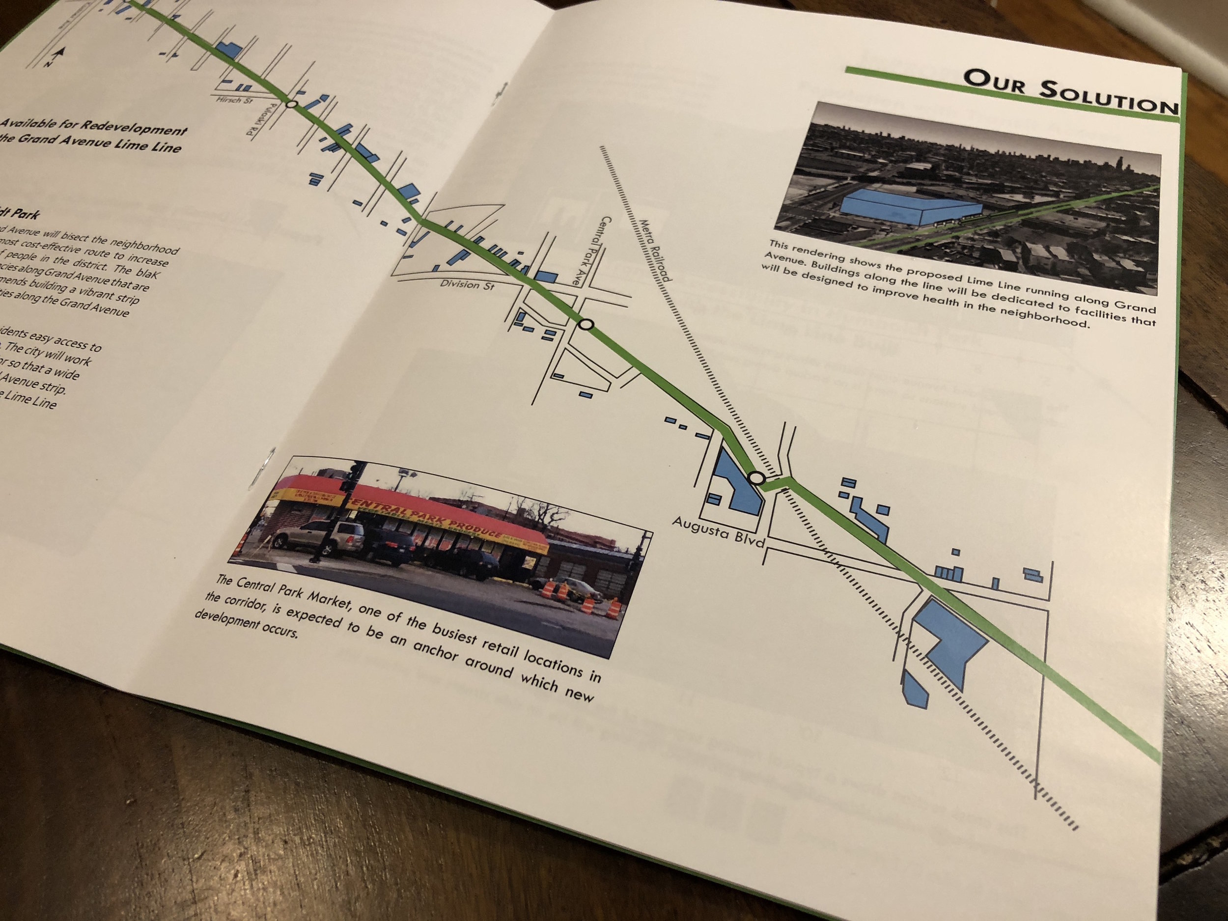
The centerfold showed the Lime Line going through the community, with vacant lots on Grand Avenue highlighted in blue. We described how the neighborhood’s industries would be better connected by the new line.
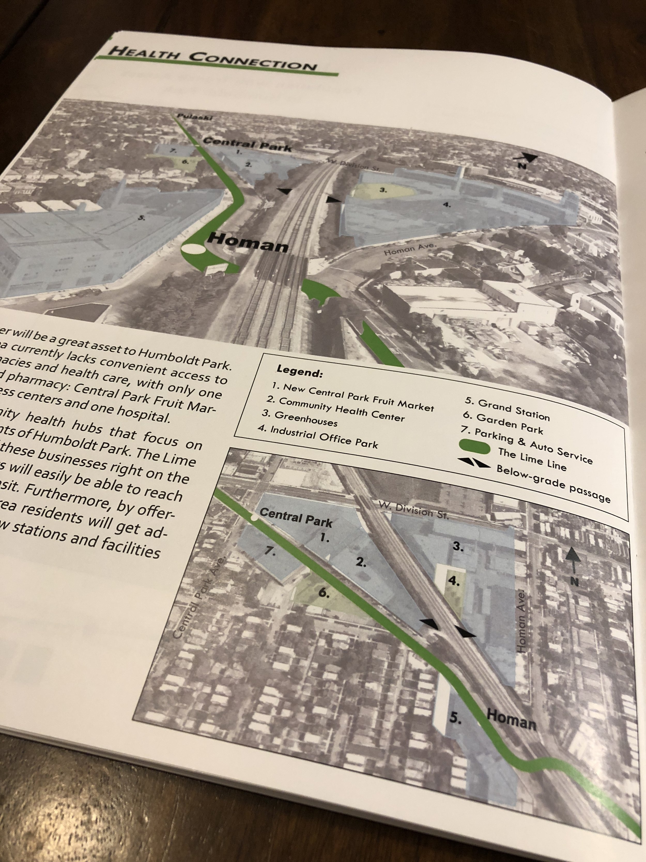
I also made an aerial view using Google Earth and Illustrator to show how added density would allow for more amenities at “Grand Station” on Grand and Homan.