Where have all the corner stores gone?
Wicker Park is a lot of fun to walk around, for about a zillion different reasons. There are lots of little Chicago stories around, from the recent arts history to the orphanage turned into a $3M mansion. I have become particularly interested in all the half-hearted renovations to the old buildings here in West Town, including my own:
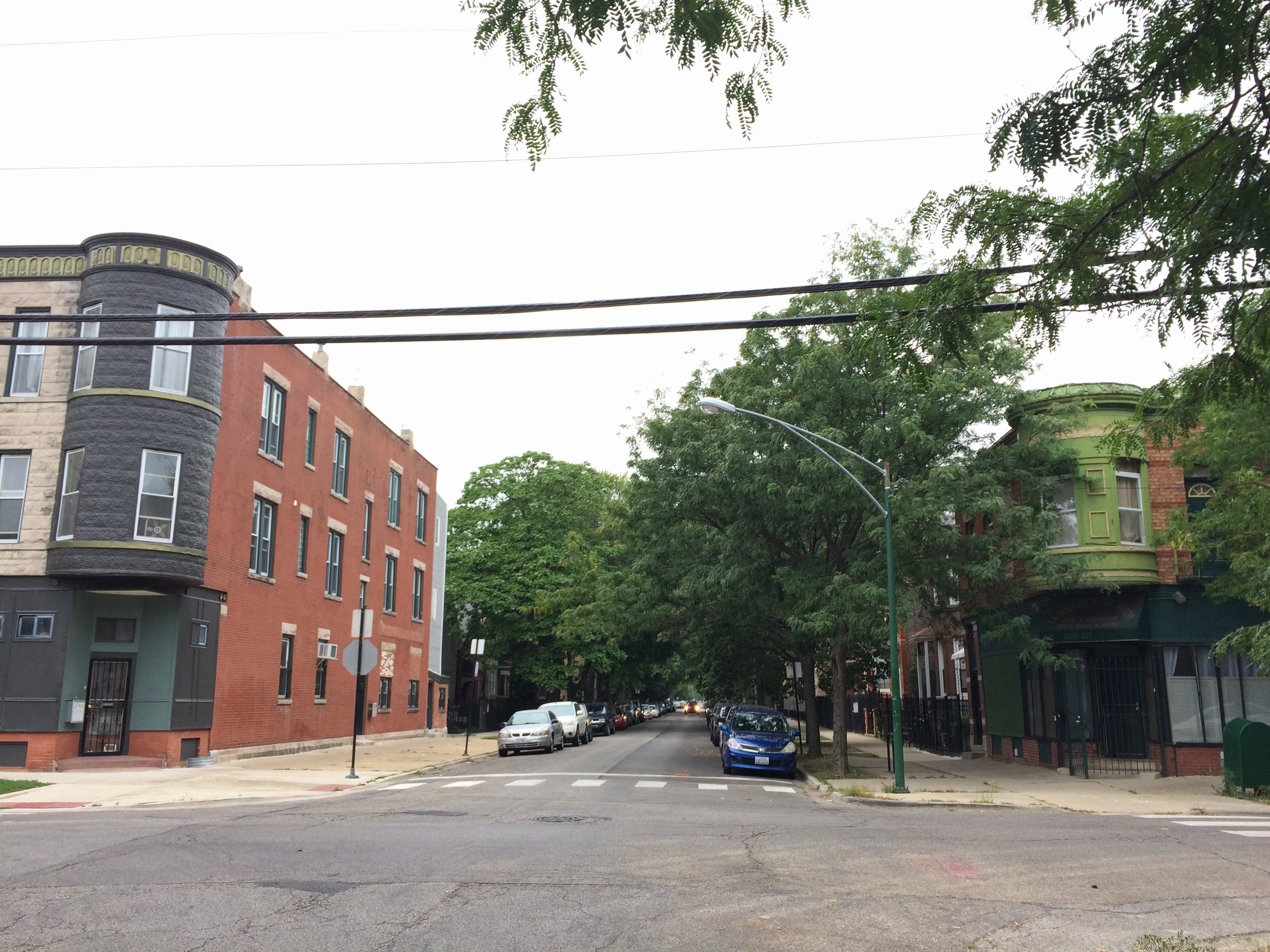


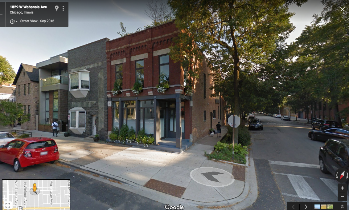
Nobody wants an overhead turret. Nor a tiny triangle garden, or a windowless front, or a full glass-brick exterior wall (okay, maybe someone wants that 1930s look). These weird modifications weren’t made with today’s Wicker Park renters in mind. So who were they for?
Fortunately, we have University of Chicago’s “Government Maps of Chicago in the 1920s, 1930s and 1940s” collection to shed some light on this. I am going to focus on the block of LeMoyne between Bell and Leavitt for a few reasons: it’s changed a lot, it’s near where I live, and the presence of Albert R. Sabin School means it’s easy to find on a map.
As early as 1922, there are maps showing commercial spaces up and down Leavitt, as well as a couple on Bell:
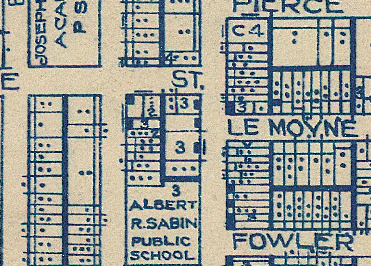
Leavitt and Le Moyne on a 1922 map
This high-contrast 1925 map does a much better job showing what we’re talking about. Those white boxes are “commercial frontage.”
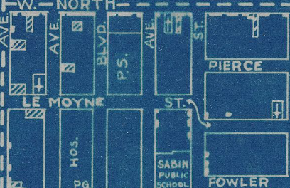
Leavitt and Le Moyne, showing commercial frontage in white.
Also visible here is a North Ave. streetcar and a couple industrial spots on that main road. On North between Bell and Leavitt is a Lutheran Church – still standing, though perhaps to be redeveloped – and what is shown as a “Chinese Laundry” in other maps of the time. The laundry building is no longer around.
West Town in the years before the depression was a finely-grained urban community. Most streets had a handful of shops, saloons or the like as well as two-to-three story brick residential units. Most often, those shops would be on the ground floor of the residential units.
So what happened? To be glib, the 20th century happened. Decisions made by politicians on every level of government changed the way this neighborhood behaved, if not necessarily the way it looked.
The story of mid-century urban change, from Federal Housing Authority (FHA) mortgage maps to highway expansion all the way through has been well-documented. Here’s a couple of great examples from Whet Moser’s work. And, of course, “The Case for Reparations.”
The area east of Humboldt Park was squarely redlined in the Home Owners Loan Corporation (HOLC) maps.

In this 1938 Chicago Housing Authority map, the area is marginal between “C” zones – where the FHA would back 10-year mortgages only – and redlined “D” zones where no mortgages would be backed.
This 1942 blight map is perhaps a bit more optimistic. The area around North and Western is only “Near Blighted” according to the Chicago Plan Commission.

This is a pretty poorly-made map, but the area just east of Humboldt Park is zoned as less-risky than the areas closer to railroad lines.
Of all the bummer descriptions of mid-century Wicker Park, this might be the map that saved the built environment of the neighborhood. A finding of blight meant the city could “acquire and dispose of devalued properties,” as Rachel Weber describes the process in From Boom to Bubble. Blight, in its legal definition, is a pretty binary thing: a property is either blighted or it is not. “Near Blighted” is not “Blight.” The brick buildings and their storefronts stuck around.
The neighborhood, of course, changed even if the buildings did not. I don’t want to get into the ethnic and racial makeup of post-1950 Wicker Park, mostly because I know even less about that and can’t find the resources yet. John Betancur, a professor at UIC who has studied the area in depth, is currently on sabbatical. I hope to have a Part Two when I get the chance to speak with him later this year.
What I do have is the 1957 Zoning Map for Wicker Park. The vast majority of those residential storefronts have been banned, as it’s virtually all R3 or R4 (residential-only, with a Floor-to-Area ratio of .7 or 1.2, respectively). It’s not single-family housing, but it’s about as low-density as you can get. Which helps explain why the storefronts are gone — there’s a whole lot fewer people to spend money at them.

By 1957, the vast majority of Wicker Park is zoned residential-only outside of North and Milwaukee.
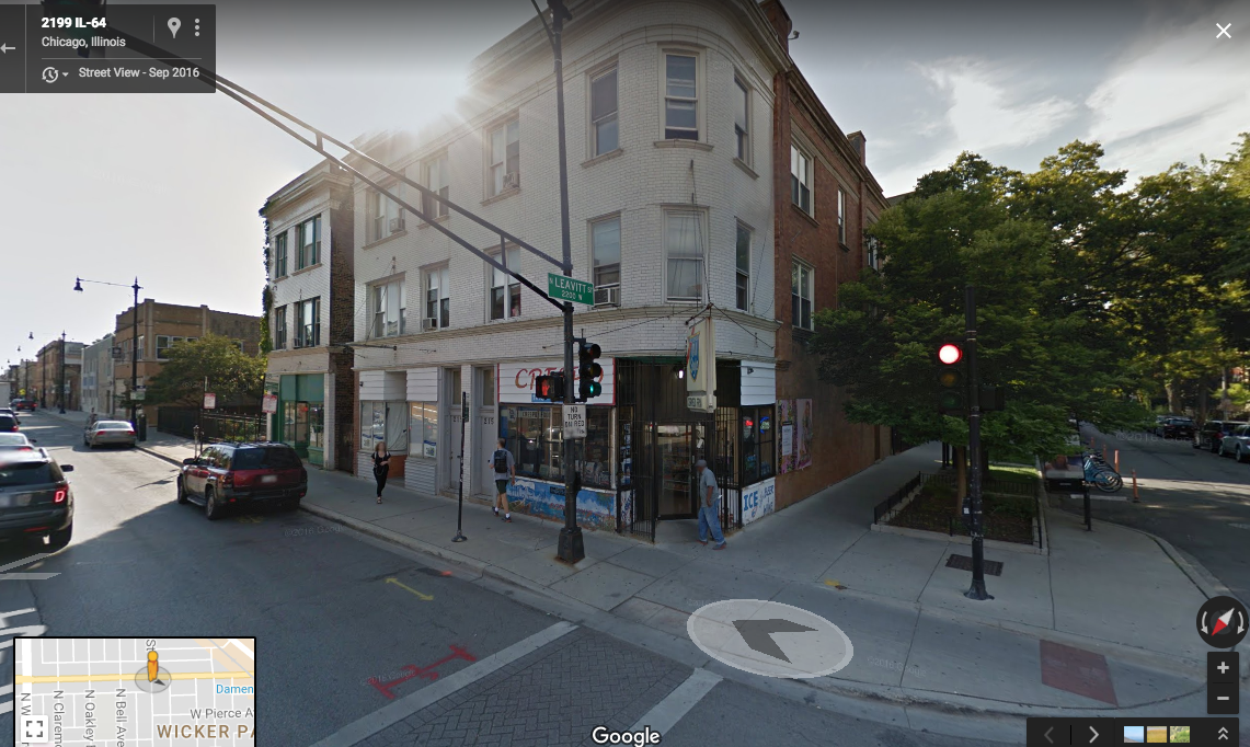
There is that notable bit of BI-2, at what looks to be an old tavern. It’s zoned for local retail, with a Floor-to-Area ratio of 2.2. I would love to figure out what used to be there, but I don’t know quite yet.
Today’s zoning map looks a whole lot like 1957, albeit with a “Wicker Park Historic District” overlay that was enacted in the ‘70s. That BI zoning on the corner of Leavitt and Le Moyne looks similar, but that tavern-looking building has lost its retail zoning.

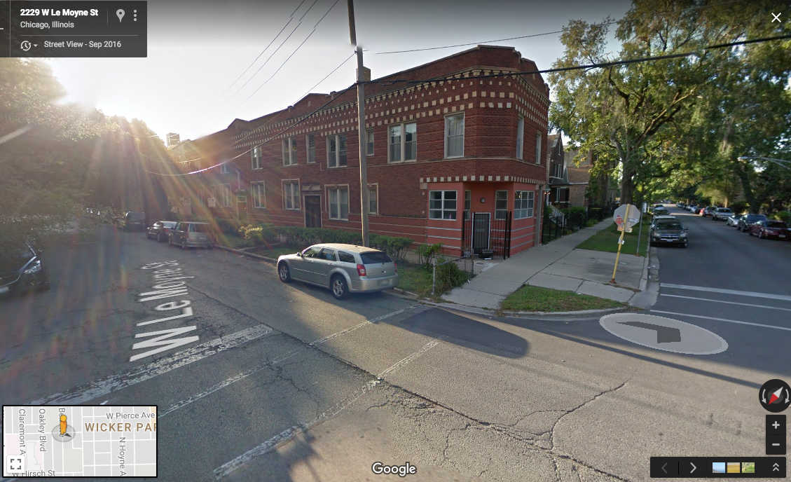
Now it’s four residential units that could be zoned to include retail. I don’t think that will happen anytime soon.

What does this mean for me? Not a whole lot. I don’t live in that window-less tavern. I am able-bodied enough to walk up to North Avenue in order to get groceries or a coffee.
But higher density and more mixed-use would make things much easier for the older folks in the senior housing on Pierce. Something cheaper than the $7 ice cream at the corner store on Leavitt would probably be welcome for the kids at any of the zillion schools nearby. There’s a lot that could make life more pleasant for people who aren’t my age, my class, and my income bracket – and there’s the infrastructure in place to have it be so. It just needs a change in zoning.
Until then, these re-used commercial storefronts tell one more story about Chicago in the 20th century. The buildings are too useful to be razed by the city, not useful enough to be redeveloped into something new. They’re instead rented out to 20-somethings who want to be near public transit and some fancy bars. Without a vision for something else or a directed capital campaign, the neighborhood is in this Goldilocks zone that seems to be just good enough for just enough people.